Experience a lagoon shaped by a continental glacier
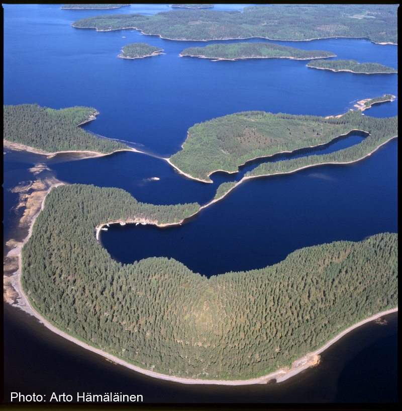
Taka-Ruuho and Ruuhonpurnu from Ruuhonsaari islands consists of a core esker ridge running from northwest to southeast and a delta formation deposited at its southeastern end. The delta’s formation was shaped by the rocky Ruuhonpurnu hill to the west and the ice mass that filled the Taka-Ruuho bay to the east. The shape of the ice mass is reflected in the sheer edges of the deep lagoon-like area. The clearest ancient shoreline to develop in the Ruuhonsaari islands relates to the highest phase of Greater Saimaa. The clear ancient shoreline formed over a long period of time (elevation 83.3-83.8msl) and was left dry with the breakthrough of Vuoksi 5,700 years ago; the related shore terrace is exceptionally extensive on the Honka-Ruuho island.
The harbour has a quay, two campfire sites and a sauna, as well as a Saimaa Geopark sign.
Ruuhonsaaret is one of the destinations in the From Ancient Sea to Saimaa trail.
Image: Arto Hämäläinen
Coordinates
Geographic coordinates
61.350431254, 28.111179501
GPS-devices
x=559433,847 y=6802326,778
